UN
17 Newark Lane
£ 345,000
Description
We don't have a Description for this property.
- Bedrooms
- 2
- Bathrooms
- 0


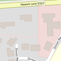


Leaflet © OpenStreetMap contributors
The heatmap indicates the level of crime in the area. The color of the heatmap indicates the crime severity and recency.
Metrics Year-on-Year
- Average area value
- 616,782.00 £Increased by 0.50 %
- Average area rental value
- 2,686.00 £/moIncreased by 42.57 %
- Est rental Yield
- 5.23 %Increased by 42.12 %
- Crime Rate
- 40.00 %Unchanged by 0.00 %
from 613,705.00 £
from 1,884.00 £/mo
from 3.68 %
from 40.00 %
Nearby Schools
| Name | Type | Ofsted | Distance |
|---|---|---|---|
| Ripley Court School | Other Independent School | 0.67 KM | |
| Pyrford Church Of England Primary School | Academy Converter | 3.10 KM | |
| Pyrford & Byfleet Sure Start Children'S Centre | Children's Centre | 3.19 KM | |
| Send Cofe Primary School | Voluntary Aided School | Good | 3.45 KM |
| The Marist Catholic Primary School | Academy Converter | 4.17 KM |
Images
Nearby Streets
| Name | Average Price | Average Sqft | Distance |
|---|---|---|---|
| Ripley Common | £ 650,000 | 0 | 0.00 KM |
| Ryde Close | £ 1,000,000 | 0 | 0.00 KM |
| Ripley By-Pass | £ 0 | 0 | 0.00 KM |
Nearby Transport
| Name | NLC | TLC | Distance |
|---|---|---|---|
| Clandon | 5555 | CLA | 4.11 KM |
| West Byfleet | 5684 | WBY | 4.45 KM |
| Byfleet And New Haw | 5689 | BFN | 5.75 KM |
| Woking | 5685 | WOK | 7.02 KM |
| Horsley | 5562 | HSY | 7.11 KM |
Nearby Listings
| Address | Price | Type | Score | Distance |
|---|---|---|---|---|
| 43 Newark Lane, Ripley, GU23 | £ 425,000 | BUY | 6 / 10 | 0.01 KM |
| Wentworth Close, Ripley, Woking, Surrey, GU23 | £ 875,000 | BUY | Unknown | 0.09 KM |
| High Street, Ripley, Woking, Surrey, GU23 | £ 525,000 | BUY | Unknown | 0.21 KM |
| Georgelands, Ripley, Surrey, GU23 | £ 500,000 | BUY | 6 / 10 | 0.24 KM |
| Newark Lane, Ripley | £ 315,000 | BUY | Unknown | 0.25 KM |
Nearby Properties
| Address | Price | Distance |
|---|---|---|
| 27 Newark Lane | £ 390,000 | 0.00 KM |
| 17 Newark Lane | £ 345,000 | 0.00 KM |
| 29 Newark Lane | £ 360,000 | 0.00 KM |
| 61 Newark Lane | £ 120,000 | 0.02 KM |
| 37 Wentworth Close | £ 607,000 | 0.09 KM |